Southernmost Point and Mile Marker Zero: is the drive worth it?
The first time I stood in front of the Southernmost Point buoy, I’d been in the car for almost four hours and I still had to wait behind eleven people for my turn at the paint. That’s the part nobody puts in the photo. The buoy itself — red, black, and yellow, marking “90 miles to Cuba” — sits on a low sea wall a couple of blocks off Duval Street, and it takes about ninety seconds to see it, touch it, and take your picture. Everything else is the getting there.
I want to be straight about what this concrete marker actually is, because it gets oversold constantly. It’s not a monument with a story you can spend an hour absorbing. It’s a painted buoy, privately maintained, marking the closest publicly accessible point to Cuba in the continental United States — and it happens to sit at the literal southern edge of the country. That’s it. That’s the whole attraction. What makes it worth writing about isn’t the buoy, it’s the line waiting to touch it, and what that line tells you about why people come all this way for a symbol.
What “southernmost” and “mile marker zero” actually mean
Key West is the southernmost city in the continental United States, full stop — not “one of,” the actual southernmost point you can drive to. It sits roughly 90 miles from Cuba, close enough that on a clear day locals will tell you they’ve seen its outline, though I’ve never managed it myself. The buoy marks that fact. A few blocks away, near the corner of Whitehead and Fleming, there’s a second, quieter marker: Mile Marker 0, the literal end of the Overseas Highway, the same US-1 that, if you followed it the other direction, would eventually put you in Maine. I find that second marker more interesting than the famous buoy, honestly, because it’s the one that tells you where you are in relation to everything else — the end of the road, not just the end of the country.
And the road really does end there. Not “the road gets difficult” or “the road gets remote” — it stops. There is no continuing south by car. If you’re standing at that buoy imagining you could keep driving toward the Dry Tortugas, you can’t. That park sits about 70 miles further west into the Gulf, and the only ways in are the official park ferry, a seaplane, or a private or chartered boat. No causeway, no bridge, no road extension ever built or planned. The Overseas Highway’s 42 bridges get you to Key West and no further.
The drive people underestimate
Here’s the number I wish someone had given me before my first trip: Key West is about 160 miles from Miami, and on the Overseas Highway that’s 3.5 to 4 hours each way, without stops, without traffic, without a slow-moving RV in front of you on a two-lane stretch through Islamorada or Marathon. Add stops and it’s closer to 5. That is not a quick side trip you tack onto a Miami beach day. It’s a genuine road trip, 113 of those miles and 42 bridges run in a single stretch from Key Largo down, including the Seven Mile Bridge, which is its own experience entirely.
I’ve seen the day-trip version marketed as easy, and technically it’s possible — bus tours run it, and some travelers do drive down, see the buoy, walk Duval Street for two hours, and drive straight back. But you’re looking at 7 to 8 hours of round-trip driving for maybe 3 hours on the ground. If you compare driving yourself against a guided bus day trip, the bus at least lets you sleep or read instead of watching the road, but it doesn’t shrink the distance. I did the single-day version once and regretted rushing it.
What changed everything on my second trip was staying one night. Suddenly Duval Street after dark, the Mallory Square sunset crowd, a slower breakfast before driving back — all of it fit, instead of being crammed into a photo stop between two exhausting drives. If you’re weighing whether Key West is worth a day trip from Miami at all, my honest answer is: it’s worth going, but treat the buoy as a bonus you catch on your way to something bigger, not the reason for the whole trip.
Making the buoy actually worth the queue
If you do make it down, a few things help. Go early — before 9am if you can manage it, because by midday the line for the photo can run fifteen or twenty minutes deep, and the light is flatter anyway. Combine it with Mile Marker 0 a few blocks away, since almost nobody bothers with the second marker and it’s a better quiet moment. And treat it as one stop among several rather than the whole itinerary: Duval Street, the sunset crowd at Mallory Square, a Hemingway house visit, maybe a snorkeling trip or a sunset boat cruise if you have the extra day. For food between stops, Key West’s food and drink scene is worth building time around rather than squeezing in.
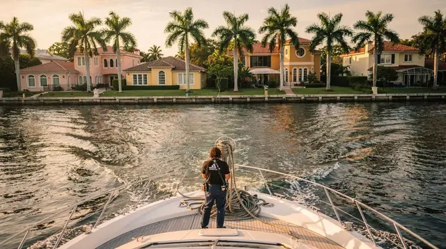
If the 8-hour round trip genuinely doesn’t fit your schedule, I’d rather tell you that honestly than pretend it’s a quick detour. Miami itself has plenty that doesn’t require a full day in the car — a couple of hours out on the water works as its own afternoon, whether that’s chartering a yacht around Biscayne Bay or taking a faster speedboat ride past the waterfront mansions. If you want a different kind of “edge of the map” feeling without the four-hour drive, an airboat ride through the Everglades gives you a landscape just as unlike the rest of Florida. None of that replaces standing at the actual Southernmost Point, but it’s worth knowing your options before you commit a full day — or two — to the drive.
For planning the logistics, a full Key West day trip guide and the itinerary for driving Miami to Key West cover routing and timing in more depth than I can here. Check current conditions and distances before you go, and browse general travel tips for the Keys if this is your first run down the Overseas Highway.
Southernmost Point FAQ
How far is the Southernmost Point from Miami?
About 160 miles by road, following US-1 and the Overseas Highway. That translates to roughly 3.5 to 4 hours of driving each way without stops, longer with traffic or a slower pace through the Keys.
Can I visit the Southernmost Point and Dry Tortugas National Park in the same day?
No. The Dry Tortugas sit about 70 miles further west into the Gulf and are only reachable by the official park ferry, a seaplane, or a private or chartered boat — there’s no road connection. Plan them as separate outings, and check ferry and seaplane options well in advance since space is limited.
Is the Southernmost Point buoy worth visiting on a rushed day trip from Miami?
It’s a genuine landmark, but a same-day round trip from Miami means roughly 7 to 8 hours of driving for a few hours on the ground. If you can, an overnight stay turns a rushed photo stop into a proper visit to Duval Street and the rest of Key West.
What is Mile Marker 0 and how is it different from the Southernmost Point buoy?
Mile Marker 0 is a separate, quieter sign near Whitehead and Fleming Street marking the literal end of US-1 and the Overseas Highway. The Southernmost Point buoy, a few blocks away, marks the closest publicly accessible spot to Cuba. Both are worth a photo; neither takes more than a few minutes.
How close is Key West to Cuba?
About 90 miles. On a very clear day, some visitors report seeing a faint outline from higher vantage points, though this isn’t something to count on.
Is there a road to the Dry Tortugas from Key West?
No. The Overseas Highway ends at Key West, and there is no bridge or road extension toward the Dry Tortugas. Access is strictly by ferry, seaplane, or boat.
Is driving to Key West or taking a bus tour better for seeing the Southernmost Point?
Driving gives you control over stops along the Keys but means several hours behind the wheel each way. A bus day trip covers the same distance without the driving fatigue, though it runs on a fixed schedule. Neither option shortens the actual 160-mile distance.
tours.Landmarks
Verified deep-linked GetYourGuide tours. Book through these links and we earn a small commission at no cost to you.
GetYourGuide does not provide a product photo for this activity — the image shows the meeting point, photographed by us.