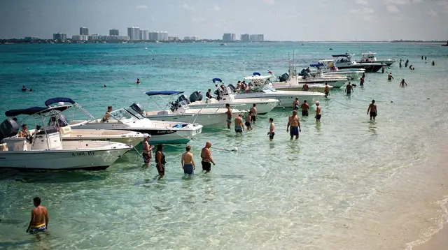
Where to see the Miami skyline from across the bay
Why I keep coming back to the same three spots
I used to assume the best skyline photo was from somewhere in Downtown or Brickell itself — get close, look up. That is backwards. The Downtown and Brickell towers only read as a skyline once you put water between yourself and them, which means crossing onto Miami Beach or out to Key Biscayne. Both are separate towns on the far side of the causeways, not districts of Miami, and that distance is the whole point: a skyline view taken from Miami Beach is looking at Miami, it is not a view from within Miami.
Over a few visits I settled on three places that actually work, and one that gets recommended more than it deserves.
Bill Baggs Cape Florida State Park and the lighthouse
The most complete view is from the western shoreline of Key Biscayne, inside Bill Baggs Cape Florida State Park, near the old Cape Florida lighthouse. From here the whole Downtown and Brickell cluster sits across open water, low and wide rather than looming, with the bay itself doing most of the work in the frame. It is a state park, so there is a small vehicle entry fee, and the park closes at sunset — check the posted hours before you plan around golden hour, because arriving after closing means missing the last, best light.
The park also has a proper beach and shaded picnic areas, so it holds up as a stop on its own, not just a photo errand. For anything else to do on the island, the Key Biscayne guide covers it.
The Rickenbacker Causeway itself
You do not need to reach the park to get a skyline view — the Rickenbacker Causeway that connects Downtown to Key Biscayne has pull-offs and a bike and pedestrian path along parts of its length, and the middle stretch, with the bay open on both sides, gives an unobstructed look back at the towers. This is the honest option if you are short on time: you can stop for ten minutes on the way to or from the island rather than building a whole outing around the view.
It is also the route cyclists use for exactly this reason. If you are walking or biking rather than driving, budget more time than the causeway’s short length suggests — there is no shade, and the wind off the bay is constant.
South Beach’s bay side, not the ocean side
The third spot is easy to get wrong. South Beach faces two directions: the Atlantic on the east, where Ocean Drive and the Art Deco Historic District sit, and Biscayne Bay on the west, which is the side that actually faces the city. The bay-side streets and a handful of waterfront points on the western edge of the island give a skyline view that most visitors never look for, because everyone arrives thinking of the ocean side first.
This view is more built-up and closer to the towers than the Key Biscayne one — less open water, more marina and low buildings in the foreground — so it reads differently in a photo. I use it when I want the skyline as a backdrop rather than the subject.
Getting there from Downtown
All three points start from the same side of the bay. From Downtown Brickell, the causeway to Key Biscayne is a short drive, and traffic is the only real variable — allow extra time in late afternoon, which is also when you want the light. There is no Metrorail or Metromover service onto the island or across the causeway, so this is a car, taxi, rideshare, or bike trip; the guide to getting around Miami explains what the free transit actually covers, and it stops well short of Key Biscayne. If you are driving yourself, the notes on renting a car and tolls are worth reading first, since the causeway itself is a toll road.
Reaching South Beach’s bay side from Downtown means crossing one of the other causeways — MacArthur, Venetian, or Julia Tuttle — into Miami Beach, then heading to the western edge of the island rather than the beach itself.
What the view actually looks like at different times of day
At midday the towers are flat and a little washed out under direct sun. Late afternoon puts the light behind you and onto the glass, which is when the skyline actually looks like the postcard version. After sunset, building lights come on gradually — full darkness loses the shapes of the towers and just leaves points of light, so the window that works best is the thirty or so minutes straddling sunset, not full night.
None of these three points requires a tour, a fee beyond the state park’s entry, or any special access. If you would rather see the skyline moving past you than stand still and look at it, a handful of bay cruises run this same stretch of water from the other direction. A sightseeing cruise past the Brickell and Downtown skyline and the waterfront mansions covers the same towers from the water side, and an evening party boat that runs past the lit-up skyline is the closer equivalent to the after-sunset view from land, just from a boat instead of a causeway.
If skyline photos are part of a bigger list for you, the most instagrammable places in Miami piece and the best sunset spots round out the picture with locations this page does not cover — street art, architecture, and other sunset points that are not about the skyline itself. For more on the water side of things, the boat tours and yacht charters guide and the Biscayne Bay cruises from Bayside and Miami sunset cruises guides go into the options in more depth than this page needs to.
Questions about seeing the Miami skyline from across the bay
Where can you see the Miami skyline from across the water?
The clearest views of the Downtown and Brickell skyline are from the west side of Key Biscayne at Bill Baggs Cape Florida State Park, from the Rickenbacker Causeway itself, and from the bay side of South Beach. All three look at Miami from Miami Beach or Key Biscayne — you are never standing in the city while you photograph it.
Is Key Biscayne part of Miami?
Key Biscayne is its own town, reached from Downtown by the Rickenbacker Causeway. It sits across Biscayne Bay from the city, which is exactly what makes it a good place to photograph the skyline rather than stand inside it.
Do you need a car to reach Bill Baggs Cape Florida State Park?
A car or taxi is the practical option. There is no Metrorail or Metromover connection to Key Biscayne, and the causeway itself is a car and bike route, not a walking one.
Is the skyline view from South Beach the same as from Ocean Drive?
No. Ocean Drive faces the Atlantic, away from the city. The skyline view is from the bay side of South Beach, on the western edge of the barrier island, facing back toward Downtown and Brickell.
What time of day is best for photographing the Miami skyline from across the bay?
Late afternoon into sunset works well because the light sits behind you and on the towers, and the last hour before dark adds the building lights without full darkness losing the shapes.
Can you see the skyline from a boat instead of from land?
Yes. A number of bay cruises and party boat tours run past Downtown and Brickell from the water, which gives a moving, closer view than any fixed shoreline point.
tours.Inspiration
Verified deep-linked GetYourGuide tours. Book through these links and we earn a small commission at no cost to you.
GetYourGuide does not provide a product photo for this activity — the image shows the meeting point, photographed by us.